


By:
Submission
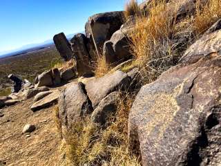
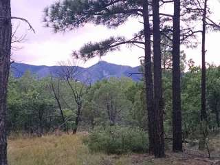
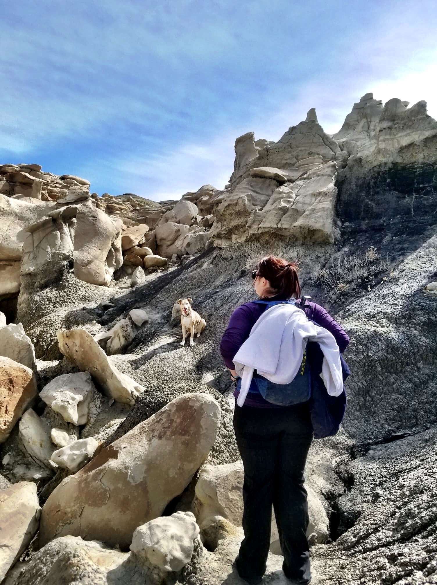
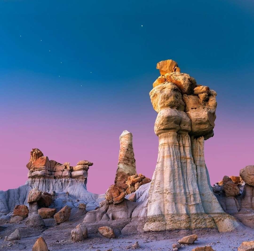
The Bisti/De-Na-Zin Wilderness is a rolling landscape of badlands which offers some of the most unusual scenery found in the Four Corners Region. Time and natural elements have etched a fantasy world of strange rock formations made of interbedded sandstone, shale, mudstone, coal, and silt. The weathering of the sandstone forms hoodoos - weathered rock in the form of pinnacles, spires, cap rocks, and other unusual forms. Fossils occur in this sedimentary landform. Translated from the Navajo language, Bisti (Bis-tie) means "a large area of shale hills." De-Na-Zin (Deh-nah-zin) takes its name from the Navajo words for "cranes".
Because of the climate, most of the visits occur in the late spring/early summer and in the fall.
Since this is a Wilderness Area, it is closed to motorized vehicles and mechanical forms of transportation (mountain bikes included).
Also prohibited are campfires, collecting fossils or petrified wood, climbing on delicate geologic features, traveling in groups of more than eight people, and trespassing on adjacent tribal lands.
Permits are required for uses such as grazing, scientific research, and commercial guiding.
Though these trailheads are off regularly maintained roads, they are not paved. County Road 7500 can become extremely slick and impassible when wet. Conditions of roads can change at any time due to weather. Drivers should avoid dirt roads during rain or snow. Drivers should be cautious of wash-out following rain or snowmelt.
Though camping in the Wilderness is a rewarding experience, there are no water sources. Visitors must carry all the water they will need for the duration of the trip.
Bisti Access Parking:
To reach the Bisti Access Parking Area, Drive NM 371 just under 36 miles south of Farmington (from the San Juan River crossing) or just under 45 miles north of Crownpoint (from the intersection of 371 and Navajo Service Route 9), and turn east on Road 7297 (a gravel road). Drive Road 7297 for approximately 2 miles to a T-intersection and turn left. Drive just under one mile to the Bisti Access Parking Area, which is just south of a broad wash on the east side of the road. There is another, smaller parking area 1/4 mile further north.
De-Na-Zin Trailhead:
To reach the De-Na-Zin access, Drive NM 371 approximately 43 3/4 miles south of Farmington (from the San Juan River crossing) or approximately 37 1/4 miles north of Crownpoint (from the intersection of 371 and Navajo Service Route 9), and turn east on County Road 7500. Drive approximately 13 1/4 miles on Road 7500 to the De-Na-Zin parking area (on the left side of the road). Alternatively, drive US 550, 4 miles north of NM 57, and turn west onto County Road 7500. Drive approximately 11 1/4 miles to the De-Na-Zin parking area (on the right side of the road). A trail leads from the parking area approximately 3/4 mile to the De-Na-Zin Wash.
None.


We just drove here expecting to catch some views, but realised later that we need to catch up on a hike which is around 3mi round-trip. We started hiking for almost a mile and then saw some footprints of an animal(which my friends guessed could of a mountain lion) since they were very fresh on wet sand, so returned back to the lot.

Such a great place, very unique to our area. Only 1 hour from Farmington!

What a surreal place. The scenery is stunning. Having read lots of reports about no signs and easy to get lost we used All Trails app which helped keep us focused when we kept wandering off entranced by the rock formations!

Wonderful hiking experience. Was here in October 2023. As others have noted, trails (if any) are not marked, so a VERY good topo map or GPS is required. If using an app like Gaia or AllTrails, download the maps as there is very minimal cell service. Another hint if you're using an app, make sure you phone is fully charged and turn off your Wi-Fi as this will save battery power (you won't be able to use it within Bisti, anyway).
And, as others have noted, bring plenty of water. Use sunscreen and wear a wide brim hat. Plus a kerchief or Neck Gaiter might be helpful to keep out dust as it does get pretty windy at times.